
OUR SERVICES
“If you are looking for expert advice, innovative solutions and unparalleled technical support, Geosearch looks forward to hearing from you. “
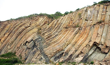
Geological Studies
- Geological / Structural mapping, cross-section measurements, neo-tectonic studies and stress analysis.
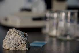
- Stratigraphical / Sedimentological field surveys, sampling and analyses.
- Minerals investigation, exploration, evaluation and reserves estimation.
- Kinematics– Tectonic Studies and Analysis.
- Raw material evaluation and investigation.
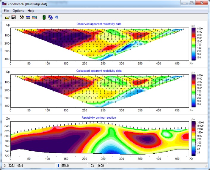
Geophysical Studies
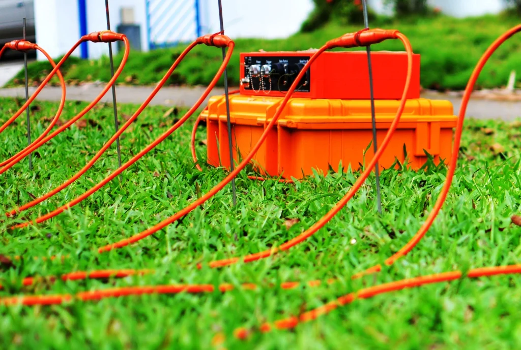
- Geophysical survey includes collection of Electrical Resistivity, Magnetic and Gravity data, its interpretation and preparation of final maps for qualitative and quantitative interpretation.
- ERT (Electrical Resistivity Tomography) is a near-surface geophysical method that uses direct current to measure the earth’s resistivity.
- Borehole logging which includes SP, SPR, GAMMA, CALLIPER, LONG NORMAL, SHORT NORMAL AND DENSITY LOG.
- Shallow Seismic Refraction Survey, Seismic, Cross-hole and Down-the-hole survey.
- Soil corrosion factor study along pipeline route for anti corrosive design.
- Selection of promising tube well sites, Delineation of aquifer, Demarcation of fresh/saline interface, Delineation of water bearing structure in bedrock.
Groundwater Studies
- Delineation of promising aquifer, selection of suitable sites for tube wells installation, Delineation of fresh water bodies in saline zones, Investigations for buried channels.
- Performance of Aquifer test, pumping test data analysis for determination of hydraulic characteristics such as transmissivity and storage coefficient, Designing, Development and planning for the establishment of water well field area.
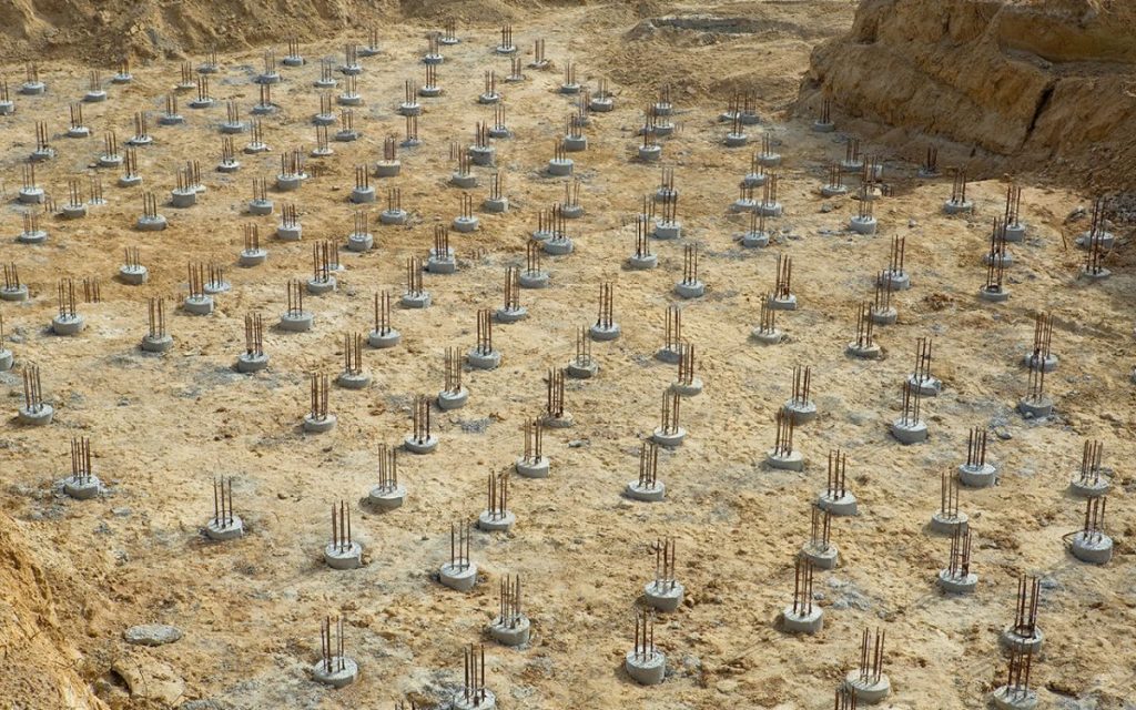
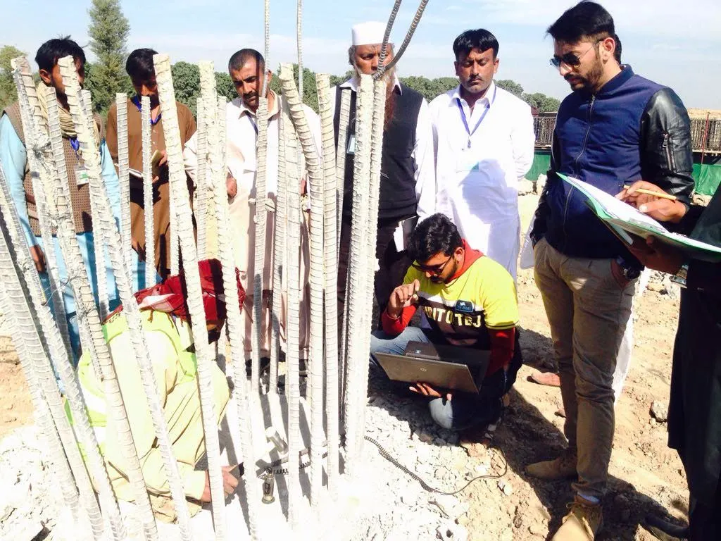
Geo-Technical Investigation & Drilling
- Geosearch is fully capable and resourceful to undertake any assignment of geotechnical investigation for high rise buildings, bridges, roadways, hydraulic structures, sensitive structures using latest and industry standard equipment with professional excellence.
- Geotechnical services also include Piling Works, Soil Dynamics / Liquefaction Studies, Rock Mechanics Studies, Slope Stability studies, Deep Excavation Support Systems,
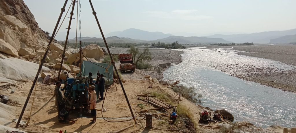
- We have facilities for all kinds of drilling for Mineral Exploration, Quarry Investigations, Tube well drilling and Piling.
- Geosearch having necessary equipment and capabilities for diamond as well as other types of core drilling up to the depth of 200 meters for geotechnical investigations with NX, NQ, BX, BQ sizes using single, double and triple tube core barrels.
- For Tube wells we have the facilities to drill up to 1000 feet with straight and reverse rotary drilling techniques along with D&T.
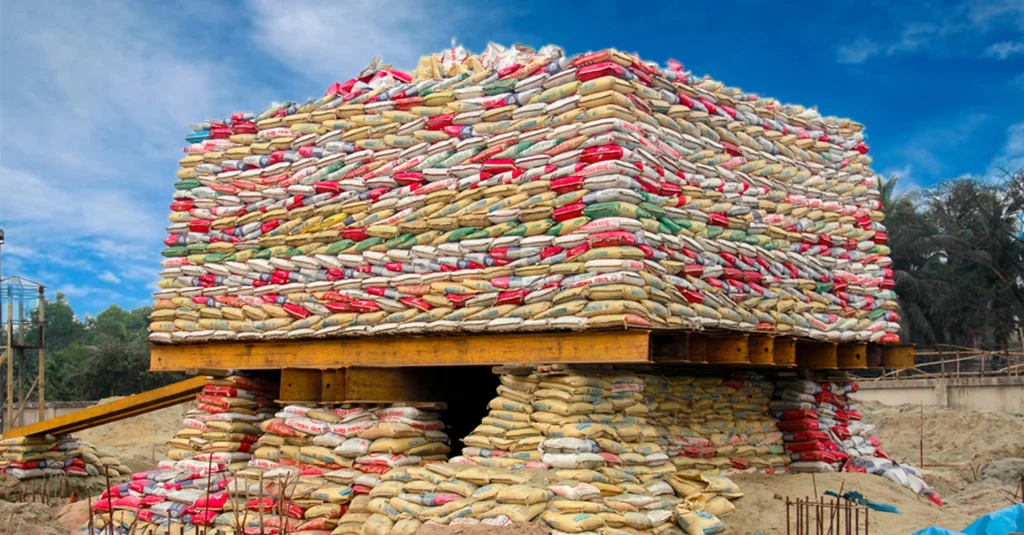
Pile Load Test
- Pile Load Test
- Test is performed with Concrete Blocks, Sand Bags, Steel Plates & Re-Bars
- Capacity upto 1500 to 2000 Tons
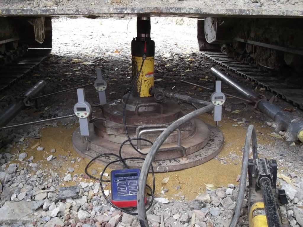
Plate Load Test
- Plate Load Test
- Test is performed with Concrete Blocks, Sand Bags, Steel Plates, Re-Bars & Truck as Loading
- Capacity upto 1000 Tons
Structure/Piling Work
- Complete Civil structural construction in all aspects including industrial foundations, rafts, buildings, trenches, culverts etc.
- Complete Piling Works execution starting right from drilling of boreholes using reverse rotary machines till cage fabrication, lowering of cage and casting of Piles.
Non-Destructive Testing (SIT & CSL)
- Sonic Integrity Testing of Deep Foundation using PET (Pile Echo Tester) of M/s PILETEST UK
- Cross Hole Ultra Sonic Monitor (CHUM) of UK
- Schmidt Hammer of Proceq for On site strength check of concrete & bricks.
- Rebar Locator of Proceq for locating the rebars in reinforced concrete.
- Concrete Core Cutting Machine.
- 3D Laser Scanner GLS 2000 for Structure Cracks Analysis.
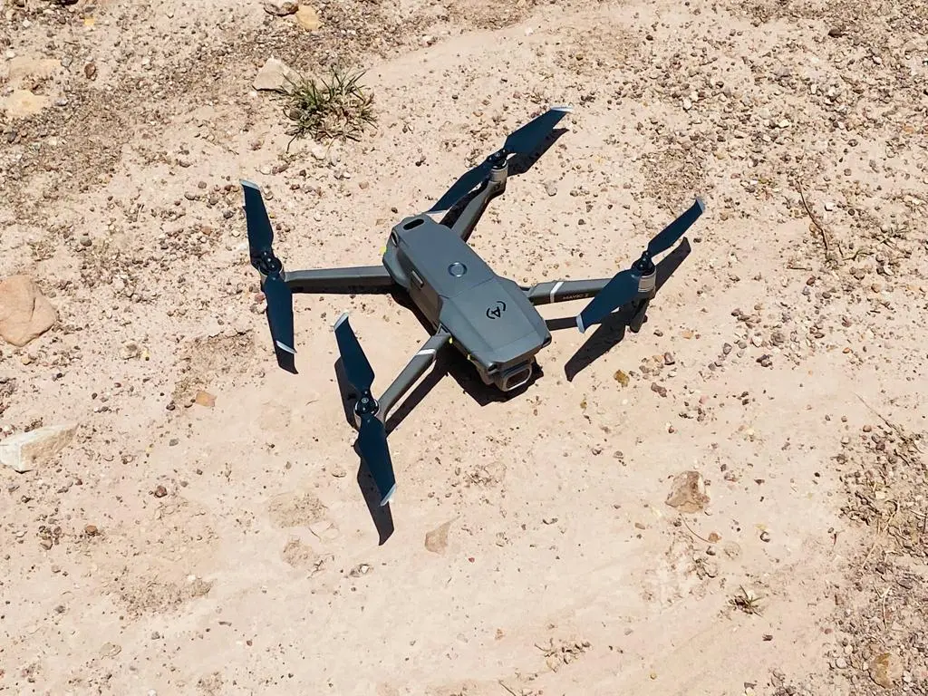
Land Surveying (Conventional & Drone Method)
- Geological mapping, cross-section measurements
- Sampling of coarse and fine aggregates
- Petrography, Engineering test results analyses and evaluation
- Material reserve calculations, Quarry planning, designing and development etc.
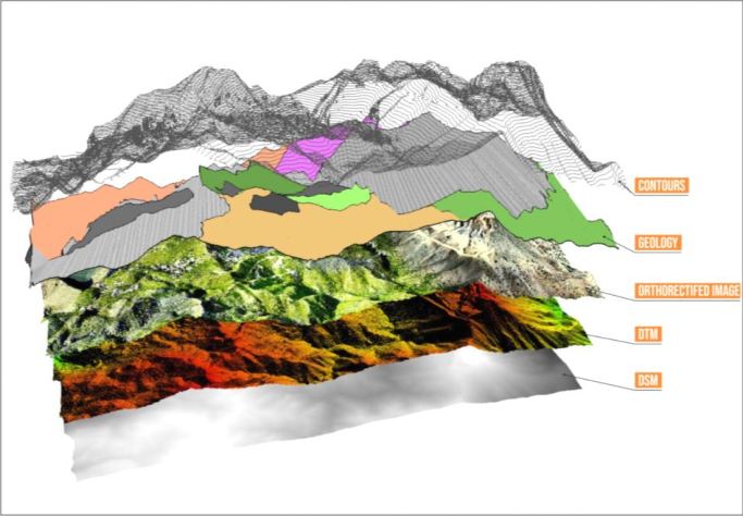
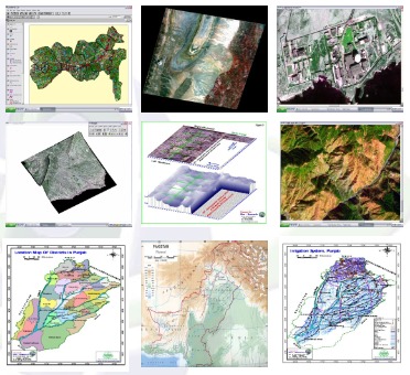
Remote Sensing & GIS
- Processing of all kinds of remotely sensed digital data, which includes Landsat ETM+, SPOT, ASTER, IRS, LISS-III, DEM/DTM, SRTM/DTED, QuickBIRD, IKONOS CARTERRA, World-View and LiDAR data for the development of earth images and their DEM/DTM at different scales for further use.
- Geological and Structural mapping / interpretation and analysis using earth imageries.
- Photo-geological and Cultural interpretation using aerial photographs, satellite imagery and radar imagery.
- Development of Geographic information system (GIS), MRIS, Cadastral Management System.
- Integration of geological / geophysical and remote sensing data for final presentation to the end user.
- Land-cover and Land-use mapping by using remote sensing data.

Environmental Monitoring & Impact Assessment
- Environmental Hazards mapping, identification and monitoring of land affected by Salinization, Water pollution mapping, Demographic and Cultural mapping (Integration of Remote Sensing data with field checks).
- Geo-chemical analysis of the Soil and Groundwater.
Construction Material Studies
- Geological mapping, cross-section measurements
- Sampling of coarse and fine aggregates
- Petrography, Engineering test results analyses and evaluation
- Material reserve calculations, Quarry planning, designing and development etc.
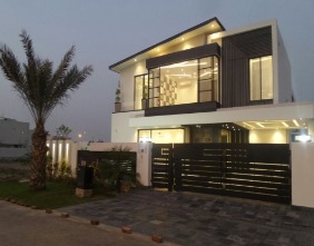
Commercial & Residential Construction
- Luxury Society Clubs
- Offices Plaza
- Shopping Mall
- Warehouse
- Offices Plaza and Clubs with Basement
- Custom Home Construction
- Smart Home Construction
- Simple Deluxe Home Construction
- High Rise Plazas
- Luxury Villas
- Entire House Remodeling
- Estimations
In House Computer Aided Mapping Facilities
- ER-Mapper Digital Image Processing and Analysis System version 5.5, 6.2,7.01
- ERDAS Imagine 8.3, 8.4 Versions
- ESRI Arc INFO 3.5, 3.5.1, 4.0, 8.1 and Arc View 3.1, 3.1.1, 8.1, 8.3
- ArcGIS 8.3, 9.1, 9.2
- AutoCAD/GIS manipulation
- AutoCAD Map
- Global Mapper 10.0
- GWW 3-D Groundwater Modeling
- Map Info/Map link
- Surfer & Grapher for windows
- MapwindowGIS